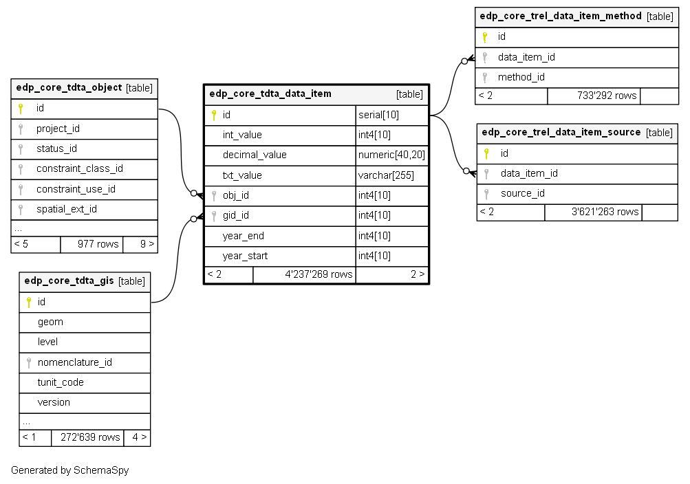
The table containing all the values (numeric and text) related to indicators. Each record is also linked to geometries through the gid_id.
Unique identifier for data items
values related to the indicator (numerical integer)
values related to the indicator (numerical with decimal)
values related to the indicator (text format)
Relation to the common object table
Relation to the common GIS table (tta_gis)
End year (4 digits) of data coverage
Starting year (4 digits) of data coverage
Table contained 1 231 269 rows